Trollheimen Triangle - English route description
3-4 days
As part of my summer 2023 Trollheimen hike, I did two and a half legs of the Trollheimen Triangle. This is one of the classic hikes in Norway - it goes in between three of the most visited cabins in Trollheimen. It’s easy to get to from Trondheim, which in turn is easily accessible from any major city in Norway via either the night train or a flight.
If you’re interested in going cabin to cabin hiking but don’t know where to start, this is a fantastic option - all of the lodges are staffed, the trails are well-marked and frequently traveled, and you get amazing views. This isn’t to say that this is an easy hike, because it has long days with quite a bit of elevation change. But it’s a good way to step into cabin to cabin hiking without jumping straight into figuring out the self-service cabin system.
If you’re looking for something less traveled, check out the West Trollheimen Triangle. If you’re looking to go longer, you can try the Trollheimen SignaTUR. This route also has the option to add on a couple of extra days to do summit tours in the area.
The Route
Day 0: Getting to Gjevilvasshytta
The easiest way to get to Gjevilvasshytta is to take the bus from Oppdal - the time table for 2023 is linked. The bus goes directly from the station to the cabin in the summer to help hikers more easily reach the cabin. If you take the bus to the cabin, you may also be eligible for a gift card at the cabin through the Green Card (Grøn kort) program. One gift card equals two fresh waffles with cream and jam, so that’s a great deal.
If you can’t take the bus directly to the cabin, you can also take a bus from Oppdal to Festa, and then walk or take a taxi along the toll roll to the cabin. You can also drive directly to the cabin, but make sure to ask the cabin about how to pay for parking and the toll - the toll must be paid in Vipps, which is an app that’s only usable if you have a Norwegian residency number.
Day 1: Gjevilvasshytta to Trollheimshytta
21.1km, 8 hours
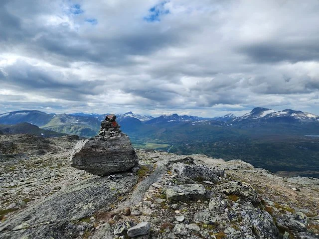
This route is one of the most varied routes in Trollheimen, taking in all different types of terrain and views. From Gjevilvasshytta, the route starts by going along the road for 1.5km to a parking lot. Here, the T-marked trail starts, going up through a forest with both birch and fir trees. The route eventually leaves the forest and crosses over a bridge, then climbs up to a lake. From here, the route continues along the east side of the lake, and then climbs steeply up to Riarskaret, a saddle. There are fantastic views from here.
The path continues onwards, dropping slightly to another lake and then going past a turn off to Vassendsetra and Bårdsgarden. From here, the route continues in easy to pass terrain before dropping steeply down to Trollheimshytta. The last part of the trail goes through open forest and myr terrain. (If you haven’t encountered myr before, it’s a Norwegian mountain swamp, which can be wet to walk through if it’s rained recently. Make sure you have waterproof shoes, and if it’s rainy, consider poles and gaiters as well.) At the very end of the route, you’ll cross a bridge and walk into the cabin.
Note that Trollheimshytta has no cell phone service, so send any messages and check the weather before you get to the cabin.
Day 2: Trollheimshytta to Jøldalshytta
There are three possible routes that you can take for this day. The “normal route”, an easier variant that goes through Svartadalen, or a trip that goes over the three tops of Trollhetta. They range in length:
Marked paths over Geithetta, 6 hours. This is a steep climb followed by a much less steep descent, with great views out onto the surrounding mountains. The trail isn’t overly rocky, although there are a few sections on the ridge that require some careful footing. The second half of this hike is the same as through the Svartadalen and is easy and flat.
Over three summits of Trollhetta, 9 hours. The route description notes that this route is not always children-friendly and recommends it only for children over 12 years old. The terrain is much more similar to the Alps than to Norwegian hiking, and you’ll drop more than 1000 meters over the course of the day.
Through the Svartadalen, 5 hours. This path goes through beautiful valleys, with great views out onto the surrounding mountains. There are many spots to stop along the way and places to go swimming as well. If you’re looking for a rest day, this is a great option - you still get fantastic views, but the trail is very technically easy.
I did this route in reverse - see my hiking notes from Jøldalshytta to Trollheimshytta.
Day 2 (option): Summit tour to Snota from Trollheimshytta
21km, 8 hours, 1400 meters of elevation gain
If you have good weather and energy, this is a great addition to the route. You’ll follow signs from Trollheimshytta to the top of Snota. The trail starts going through birch and fir forests, then starts to climb up the mountain sides. Eventually, you’ll climb above the tree line. The path will continue to climb up, and the views will become fantastic. You’ll go through terrain here with some small lakes. It gets very rocky as you continue to climb - the last four hundred meters of elevation gain are a lot of scrambling over rocks. Be prepared for that.
As you continue to climb, there may be sections that are completely covered in snow, even before you reach the glacier. In years with a lot of snow, be careful through this section, and be especially careful if you have poor visibility.
My hiking notes, partial Snota
Day 3 or 4: Jøldalshytta to Gjevilvasshytta (note: the UT link there goes to the trail in reverse)
17km, 6 hours
This is an easier hike, going through gentler terrain than the past days. The route starts by going along a tractor road towards the west for a kilometer before the marked trail turns off towards the south. There’s a bit of a climb here to Skrikhøa, followed by great views. From here, it’s flat for a bit before the trail goes down and then over a river on a year round bridge. There’s a gentle climb after you cross the bridge, with more great views. After this, the trail starts to gently decline as you enter a birch forest. The last kilometer is on a farm road to Gjevilvasshytta.
I did this route the other way - see my hiking notes from Gjevilvasshytta to Jøldalshytta