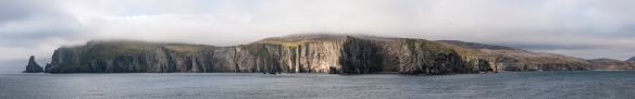
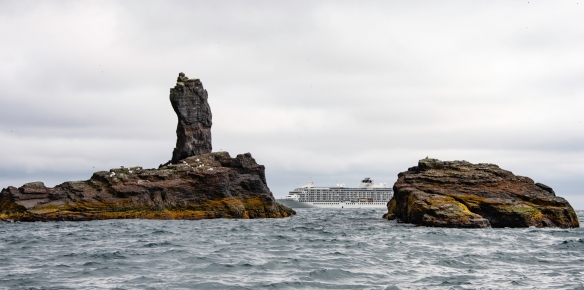
A partial panorama of Bjørnøya (Bear Island), the southernmost of the Svalbard Islands, halfway between the northern coast of Norway and Spitsbergen Island (the large, northwestern island in the Svalbard archipelago)
The Svalbard Islands, located in the Arctic Ocean halfway between Norway and the North Pole, are home to untouched arctic wilderness and unique wildlife in a setting that is both rugged and fragile at the same time. Our first stop sailing north out of Tromsø, Norway, was Bjørnøya (Bear Island), the southernmost of the Svalbard Islands, halfway between the northern coast of Norway and Spitsbergen Island (the large, northwestern island in the Svalbard archipelago). Most of Bear Island’s 176 km2 (68 square miles) are flat, with some mountainous areas in the south. The Miseryfjellet mountain is the tallest at 536 meters (1,758.5 feet) elevation. Approximately 600 small lakes are scattered around the island. Bjørnøya has a steep, almost unapproachable coastline that serves as a popular nesting site for colonies of sea birds. Around the southern tip of the island lies some of the biggest bird colonies in the world. As with the rest of the archipelago of Svalbard, Bjørnøya became a Norwegian territory in 1925.

Bjørnøya (Bear Island), Svalbard has a steep, almost unapproachable coastline that serves as a popular nesting site for colonies of sea birds
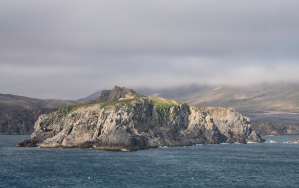
The lack of protected bays and the rough weather with strong winds and frequent fog make visiting Bjørnøya (Bear Island), Svalbard, a bit of a lottery
Bjørnøya nature reserve comprises the entire island except a small area surrounding the meteorological station that was established in 1918 as a radio- and weather-station and is still in use today, Bjørnøya (Bear Island), Svalbard
Historically, both whaling and trapping have been major activities in the Svalbard archipelago, but now sustainability is the guiding principle in every way. Nearly two thirds of the surface of Svalbard is protected and consists of several nature reserves, national parks, bird sanctuaries and even a geotopical protected area. Bjørnøya nature reserve comprises the entire island except a small area surrounding the meteorological station that was established in 1918 as a radio- and weather-station and is still in use today. The island was once the home of a major whaling station but is now inhabited by thousands of kittiwakes, murres, fulmars and many other seabirds that nest along the jagged peaks rising from the sea.

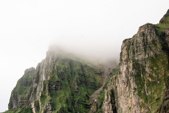
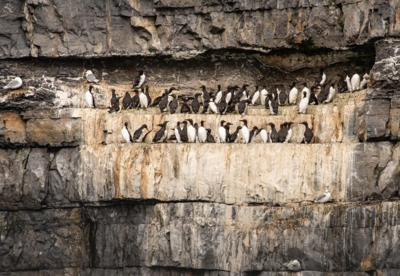
The steep cliffs of Bjørnøya (Bear Island), Svalbard, have in total hundreds of thousands of birds

The birds especially love the top of the cliffs and the oddly shaped (by the weather) vertical rock expanses, Bjørnøya (Bear Island), Svalbard

Our Zodiac tour of the southeast coast of Bjørnøya (Bear Island), Svalbard, included a journey into and through this cave

Remains of a wrecked ship on the coast of Bjørnøya (Bear Island), Svalbard; the Zodiac from our ship gives a sense of scale to the wreck and the cliffs

We saw several waterfalls on the cliffs along the southeast coast of Bjørnøya (Bear Island), Svalbard
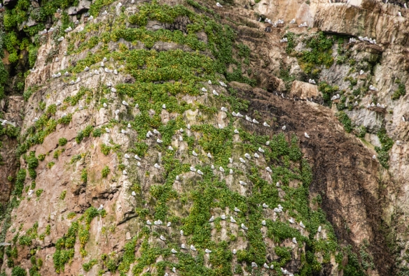
A small bird colony sitting on ledges carved by the weather erosion of the cliffs on the coast of Bjørnøya (Bear Island), Svalbard
The lack of protected bays and the rough weather with strong winds and frequent fog make visiting Bjørnøya (Bear Island) a bit of a lottery. Late morning, we went out in a Zodiac (an inflatable rubber, motorized, roughly 20-foot (6.1 meters) long boat) and cruised the coast, finding thousands of nesting birds on the 200 meter (656 foot) tall cliffs. In addition to those mentioned above, we also spotted two Atlantic puffins. The temperature was about 7 degrees C (45 degrees F), a little warmer than usual for August, with strong (25+ knots) winds. Needless to say, we all wore our Arctic waterproof pants and boots, along with heavy waterproof jackets
This scene was more typical of the cliffs – birds everywhere! — Bjørnøya (Bear Island), Svalbard
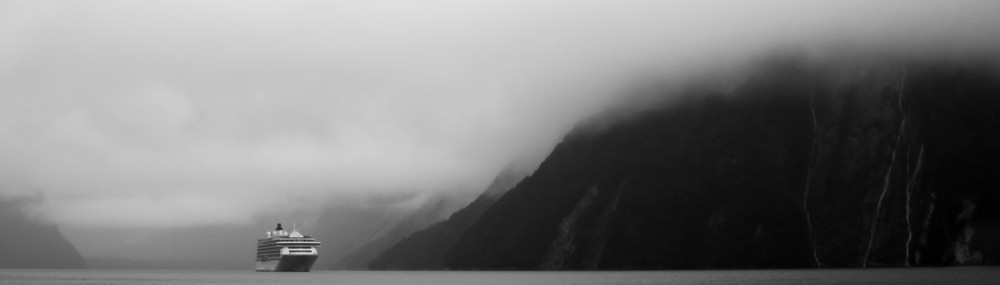
Our ship anchored off Bjørnøya (Bear Island), Svalbard
Legal Notices: All photographs copyright © 2018 by Richard C. Edwards. All Rights Reserved Worldwide. Permission to link to this blog post is granted for educational and non-commercial purposes only.

Quite a majestic area.
LikeLike