Corfitz Ulfeldts Skamstøtte
Corfitz Ulfeldts Skamstøtte is a memorial in Copenhagen municipality, Capital Region. Corfitz Ulfeldts Skamstøtte is situated close to the restaurant Kanal Cafeen and Marble Bridge.Photo: Palnatoke, CC BY-SA 3.0.
Notable Places in the Area
Christiansborg Palace
 Christiansborg Palace is a palace and government building on the islet of Slotsholmen in central Copenhagen, Denmark. Christiansborg Palace is situated 260 metres northeast of Corfitz Ulfeldts Skamstøtte.
Tivoli Gardens
Theme park
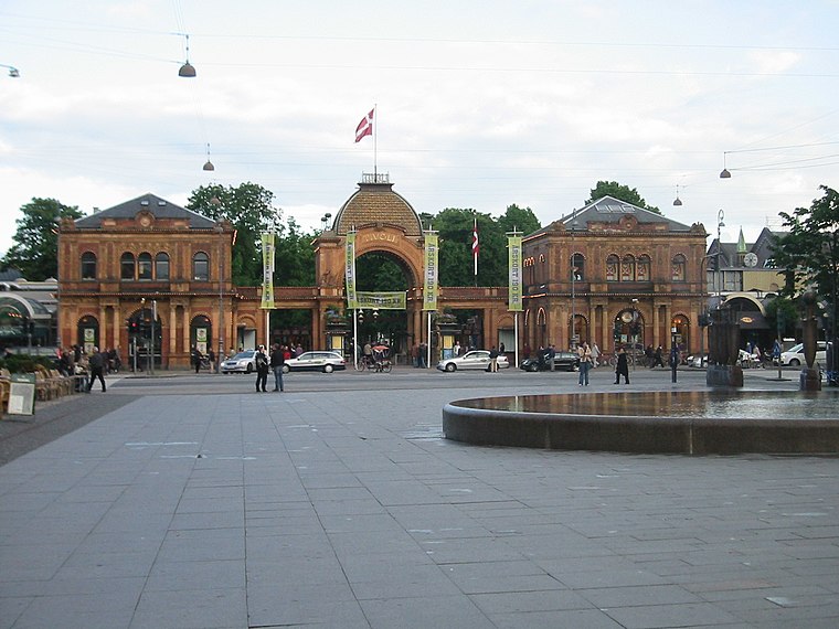
Photo: Elgaard, CC BY-SA 3.0.
Tivoli Gardens, also known simply as Tivoli, is an amusement park and pleasure garden in Copenhagen, Denmark. Tivoli Gardens is situated 450 metres west of Corfitz Ulfeldts Skamstøtte.
Museum of Copenhagen
Museum

Photo: Lauren Friedman, CC BY 2.0.
The Museum of Copenhagen is the official museum of Copenhagen, Denmark, documenting the city's history from the 12th century to the present.Museum of Copenhagen… Museum of Copenhagen is situated 180 metres west of Corfitz Ulfeldts Skamstøtte.
Localities in the Area
Indre By
Indre By is the central area and the historical heart of Copenhagen, bounded by the lakes circling the inner city and the harbour, it reflects the entire city’s extent during the reign of King Christian IV, when the town was fortified.
Christianshavn

Photo: Elgaard, CC BY-SA 3.0.
Christianshavn is a district east of the inner city of Copenhagen.
Corfitz Ulfeldts Skamstøtte
- Type: Memorial
- Inscription: Corfitz WF forræderen, Till Æwig Spott, Skam og Skiendsel
- Categories: memorial stone and historic site
- Location: Copenhagen municipality, Capital Region, Denmark, Nordic countries, Europe
- View on OpenStreetMap
Latitude
55.67461° or 55° 40' 29" northLongitude
12.5754° or 12° 34' 31" eastNamed after
Corfitz UlfeldtOpen Location Code
9F7JMHFG+R5OpenStreetMap ID
node 3578680705OpenStreetMap Feature
historic=memorialWikidata ID
Q605402Corfitz Ulfeldts Skamstøtte Satellite Map
© OpenStreetMap, Mapbox and Maxar
Also Known As
- Danish: Corfitz Ulfeldts skamstøtte
- Norwegian: Corfitz Ulfeldts skamstøtte
- Norwegian Bokmål: Corfitz Ulfeldts skamstøtte
Landmarks in the Area
- Kanal CafeenRestaurant
- Klima-, Energi- og BygningsministerietGovernment office
- Marble BridgeBridge
- Styrelsen for PatientsikkerhedGovernment office
Places in the Area
- Smör by madkastelletCoffeehouse
- Nationalmuseets MuseumsbutikGift shop
- Ubbes VinhandelLiquor store
- Pods of BeansChocolate shop, 110 metres south
- Altinget100 metres southeast
Popular Destinations in Denmark
Discover Copenhagen, Aarhus, Odense and Aalborg.
Escape to a Random Place
Discover other memorials in the world.
About Mapcarta. Thanks to Mapbox for providing amazing maps. Data © OpenStreetMap contributors and available under the Open Database License. Text is available under the CC BY-SA 4.0 license, excluding photos, directions and the map. Photo: Palnatoke, CC BY-SA 3.0.